
[ad_1]
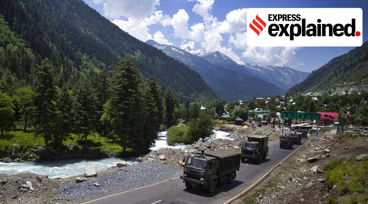 A convoy of Army vehicles moves towards Ladakh after the Galwan faceoff in May 2020. (PTI Photo/File)
On Saturday night, the Indian Army thwarted an attempt by China to change the status quo near the Line of Actual Control (LAC) by deploying its troops to a previously un-deployed area on the southern bank of the Pangong Tso Lake in eastern Ladakh. The Army said in a statement on Monday morning that Chinese troops “violated the previous consensus arrived at during military and diplomatic engagements during the ongoing standoff in Eastern Ladakh and carried out provocative military movements to change the status quo”.
While the Pangong Lake has been among the most contentious sectors in the ongoing military standoff in eastern Ladakh for nearly four months now, the activity until now had been restricted to the northern bank.
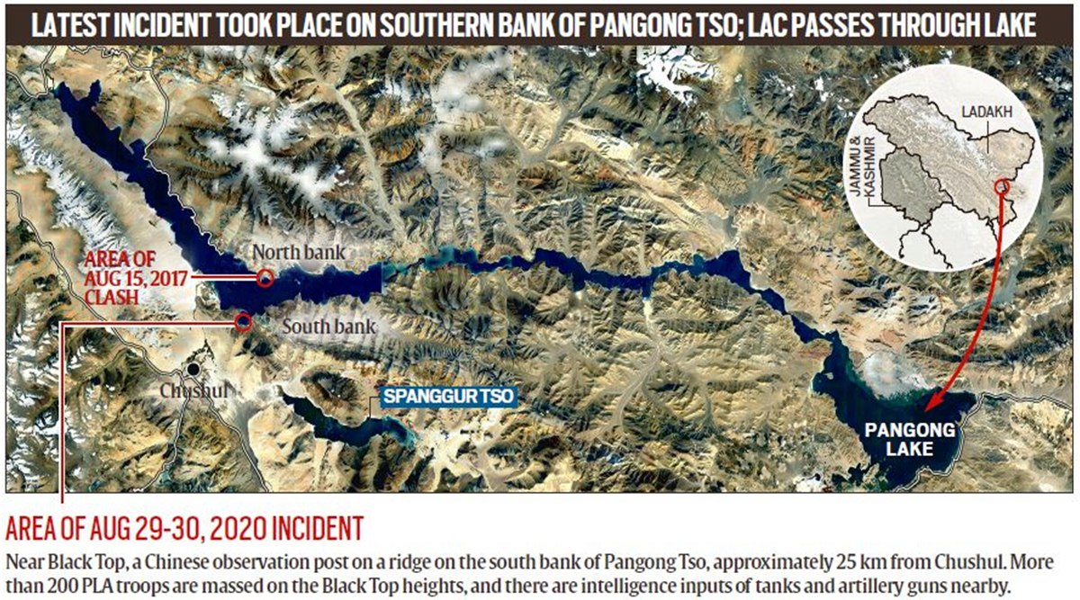 Area of August 29-30, 2020 incident
What is Pangong Lake?
Made popular by the Hindi film 3 Idiots, Pangong Tso is an endorheic lake (landlocked) that is partly in India’s Ladakh region and partly in Tibet. The name reflects the mixed heritage of the lake: Pangong in Ladakhi means extensive concavity, the word Tso is Tibetan for lake.
Situated at an elevation of about 4,270 m, it is a nearly 135-km long, narrow lake — 6 km at its widest point — and shaped liked a boomerang. Its total area is over 600 sq km.
The Karakoram Mountain range, which crosses Tajikistan, Afghanistan, Pakistan, China and India, with heights of over 6,000 metres including K2, the world’s second highest peak, ends at the north bank of Pangong Tso. Its southern bank too has high broken mountains sloping towards Spangur Lake in the south.
The lake’s water, while crystal clear, is brackish, making it undrinkable. The lake freezes during the winter, allowing some vehicular movement on it as well. (Also in Explained: Ladakh through a bifocal lens: a short zoom-in, zoom-out history)
Who controls Pangong Tso?
Nearly two-thirds of the lake is controlled by China, with just about 45 km under Indian control. The LAC, running north-south, cuts the western part of the lake, aligned east-west.
But India and China have unsettled borders, and the perception of the LAC differs in multiple sectors, including on Pangong Tso. At the lake’s north bank, according to India, the international boundary is close to Khurnak Fort, a 19th-century ruin. But the LAC, according to India, is around 15 km west. On the north bank are spurs that jut into the lake, identified as fingers. India says the LAC passes through Finger 8; China claims it is farther west.
Compared to the north bank, the difference in perception of the LAC is not very wide in the south bank. A former brigade commander from the region said the perception may differ by 100 to 200 m, and lacks prominent features like fingers.
These “differing perceptions of the LAC”, as the Army has called it, are one of the main causes of face-offs.
📣 Express Explained is now on Telegram. Click here to join our channel (@ieexplained) and stay updated with the latest
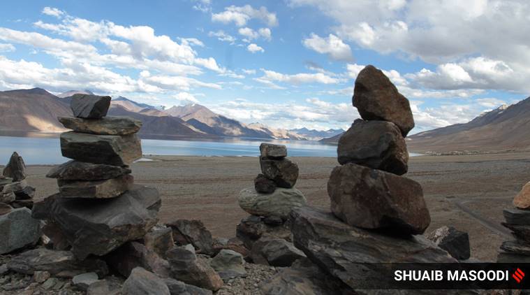 A view of Pangong Tso lake. (Express Photo: Shuaib Masoodi)
What is the current status of Pangong Tso?
The north bank was one of the two points in eastern Ladakh that saw friction in early May that led to the standoff that is now nearly four months old. On the night of May 5-6, troops were involved in violent hand-to-hand fights, though Chinese soldiers were armed with rods and nail-studded batons.
There was a similar fight in Galwan Valley on May 6. However, these violent face-offs did not result in any fatalities, unlike the June 15 clash in Galwan Valley in which India lost 20 soldiers and an undeclared number of Chinese troops were also killed.
Since then China changed the status quo and its troops had occupied the region between Finger 8 and Finger 4, which was patrolled by both but occupied by neither side earlier. Chinese troops continue to occupy the Finger 4 ridgeline, though they have stepped back from the base of Finger 4 to the base of Finger 5. But China has fortified its positions in the area.
The slight rearward movement was part of the initial disengagement process after the June 15 clashes. However, there has not been any improvement in the situation since mid-July and the talks are stuck in a stalemate.
How are the two banks different?
Until this weekend, the south bank had been quiet during the standoff. Army sources said India has traditionally had a stronger presence in the southern bank compared to the north bank, because of its proximity to areas like Chushul and Rezang La.
The former brigade commander explained that the north bank has come into the limelight only in the last few years, due to clashes between patrolling units. Traditionally the southern bank has been in the limelight, because it is just north of the Chushul approach. This is also the reason why the south bank has traditionally had a stronger presence of Indian forces.
The region south of the lake is also strategically important for both countries.
The area, known as the Chushul approach, is one of the few sectors that can be used as launchpads for an offensive, because of the plains. During the 1962 conflict, both banks witnessed a Chinese offensive, and India lost territory on both — first Sirijiap, then the entire north bank by October 22; on the south bank India had to abandon its complex of posts in Yula, and move to a high area north of Gurung Hill.
Over the weekend, the Army mentioned that Indian troops “pre-empted this PLA activity on the Southern Bank of Pangong Tso Lake, undertook measures to strengthen our positions and thwart Chinese intentions to unilaterally change facts on ground”. India has occupied a more advantageous position, though still on its side of the LAC, to prevent China from any intrusions in the area.
📣 The Indian Express is now on Telegram. Click here to join our channel (@indianexpress) and stay updated with the latest headlines
For all the latest Explained News, download Indian Express App.
© The Indian Express (P) Ltd
[ad_2]
Source link